
High-Accuracy Mapping with GNSS and Drones
In recent years, the synergy between Global Navigation Satellite Systems (GNSS) and unmanned aerial vehicles (UAVs), commonly known as drones, has revolutionized the field of mapping. This powerful combination has enabled professionals in construction, agriculture, environmental monitoring, and various other sectors to achieve unprecedented levels of accuracy and efficiency in data collection. The integration of these technologies not only streamlines workflows but also enhances the precision of geospatial data, paving the way for more informed decision-making and project planning.
The Role of GNSS in Drone Mapping
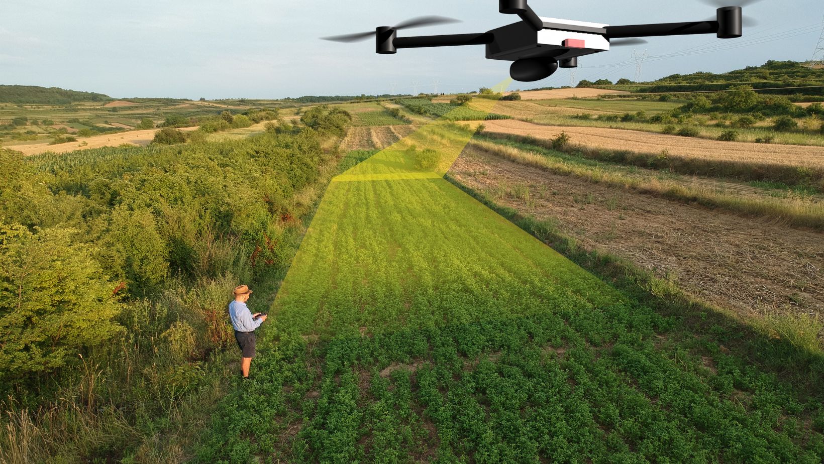
Drones equipped with GNSS technology have become essential tools for high-accuracy mapping. GNSS provides precise positioning information by triangulating signals from multiple satellites, allowing drones to determine their exact location in real time. This capability is crucial for creating accurate maps and models, as it ensures that the spatial data collected by the drone is precisely georeferenced.
A key component in achieving this level of accuracy is the use of a geodetic GNSS receiver. These receivers offer centimeter-level precision, which is necessary for applications that demand high accuracy, such as construction site surveys, infrastructure inspection, and environmental monitoring. By integrating geodetic GNSS receivers into drones, professionals can collect highly reliable geospatial data, significantly reducing the margin of error in their mapping projects.
Applications and Benefits of High-Accuracy Drone Mapping
Construction and Infrastructure
In the construction industry, high-accuracy mapping with GNSS and drones has become indispensable. Traditional surveying methods are often time-consuming and labor-intensive, requiring multiple personnel and extensive equipment. Drones equipped with GNSS technology can cover large areas quickly, capturing detailed topographic data that can be used for site planning, design, and monitoring. This not only accelerates the surveying process but also enhances the accuracy of the data collected, leading to more precise project execution.
Drones can be used to create detailed 3D models of construction sites, providing valuable insights into terrain features and potential obstacles. These models can be integrated into Building Information Modeling (BIM) systems, enabling project managers to visualize the site and plan construction activities more effectively. Additionally, drones can monitor construction progress in real time, allowing for timely adjustments and ensuring that the project stays on track.
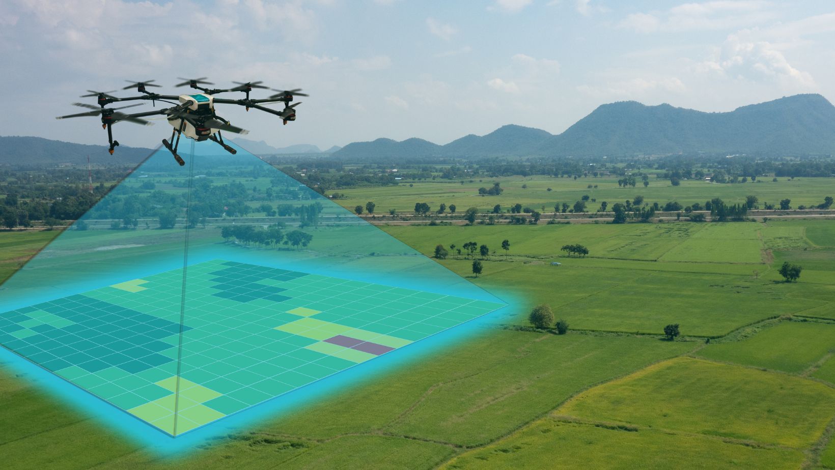
Agriculture and Environmental Monitoring
High-accuracy mapping is also transforming the agricultural sector. Drones equipped with GNSS technology can be used to create precise maps of farmland, identifying variations in soil quality, crop health, and water distribution. This information is essential for precision farming, where farmers can optimize the use of resources such as water, fertilizers, and pesticides based on the specific needs of different areas within their fields. By using drones for regular monitoring, farmers can increase crop yields and reduce environmental impact.
In environmental monitoring, drones provide a cost-effective and efficient way to collect data over large and often inaccessible areas. For example, drones can be used to monitor forest health, track wildlife populations, and assess the impact of natural disasters. The high-accuracy data collected by drones enables researchers and conservationists to make informed decisions and implement effective management strategies.
Urban Planning and Disaster Management
Urban planners and disaster management teams also benefit from the capabilities of high-accuracy drone mapping. In urban planning, drones can be used to create detailed maps of cities, identifying land use patterns, infrastructure, and potential areas for development. This information is crucial for making informed decisions about zoning, transportation networks, and public services. The ability to visualize the urban landscape in high detail helps planners design more efficient and sustainable cities.
In disaster management, drones equipped with GNSS technology can be deployed rapidly to assess damage after natural disasters such as earthquakes, floods, and hurricanes. They can provide real-time imagery and data that help emergency responders identify affected areas, prioritize rescue operations, and plan the distribution of aid. The high-accuracy maps generated by drones also assist in rebuilding efforts, ensuring that new structures are constructed in safe locations.
Technological Advancements and Integration
Advances in GNSS Technology
The effectiveness of drone mapping has been significantly enhanced by advancements in GNSS technology. Modern GNSS receivers are capable of tracking multiple satellite constellations simultaneously, including GPS, GLONASS, Galileo, and BeiDou. This multi-constellation capability improves the reliability and accuracy of positioning data, especially in challenging environments where satellite signals may be obstructed.
In addition to multi-constellation tracking, new GNSS receivers incorporate advanced algorithms that mitigate errors caused by atmospheric conditions, signal multipath, and other factors. These innovations ensure that the positioning data provided by drones is accurate and reliable, even in complex scenarios.
Integration with GIS
The integration of GNSS and drone technology with Geographic Information Systems (GIS) has opened up new possibilities for data analysis and visualization. GIS platforms allow users to overlay drone-captured imagery and geospatial data with other spatial datasets, providing a comprehensive view of the area being studied. This integration enables more sophisticated analysis, such as identifying trends, predicting future changes, and making data-driven decisions.
For example, in environmental monitoring, researchers can use GIS to analyze changes in land cover over time, assess the health of ecosystems, and model the potential impacts of climate change. In urban planning, GIS can be used to evaluate the effectiveness of public transportation systems, plan new infrastructure projects, and assess the impact of urbanization on natural resources.
Challenges and Future Directions
Technical and Regulatory Challenges
While the benefits of high-accuracy drone mapping are substantial, there are also technical and regulatory challenges that need to be addressed. One of the primary technical challenges is ensuring the reliability of GNSS signals in environments with limited satellite visibility, such as urban canyons and dense forests. Advances in signal processing and the use of auxiliary sensors, such as inertial measurement units (IMUs), can help mitigate these challenges.
Regulatory issues also play a significant role in the deployment of drones for mapping purposes. Different countries have varying regulations regarding the use of drones, including restrictions on flight altitude, airspace access, and data privacy. Navigating these regulations can be complex, especially for international projects.
Ongoing dialogue between industry stakeholders and regulatory bodies is essential to develop frameworks that balance safety, privacy, and innovation.
Future Innovations
The future of high-accuracy mapping with GNSS and drones is promising, with several innovations on the horizon. One area of development is the use of artificial intelligence (AI) and machine learning to automate data processing and analysis. AI algorithms can quickly analyze large volumes of drone-captured data, identifying patterns and anomalies that may not be immediately apparent to human analysts. This capability can significantly speed up decision-making processes and improve the accuracy of insights derived from the data.
Another exciting development is the use of swarm technology, where multiple drones work together to cover large areas more efficiently. By coordinating their movements and sharing data in real-time, drone swarms can conduct comprehensive surveys and mapping missions faster than individual drones. This technology has the potential to revolutionize large-scale mapping projects, such as national infrastructure surveys and disaster response efforts.
Conclusion
High-accuracy mapping with GNSS and drones represents a significant advancement in geospatial technology, offering numerous benefits across various industries. From construction and agriculture to urban planning and disaster management, the ability to collect precise and reliable geospatial data has transformed how projects are executed and decisions are made. The integration of geodetic GNSS receivers into drone systems ensures the highest level of accuracy, making these tools indispensable for modern mapping applications.
As technology continues to evolve, the capabilities of GNSS and drones will only improve, leading to even more innovative applications and solutions. Addressing technical and regulatory challenges will be crucial to unlocking the full potential of these technologies. With ongoing advancements and increased adoption, high-accuracy mapping with GNSS and drones is set to play a pivotal role in shaping the future of various sectors, driving efficiency, accuracy, and informed decision-making.
 How to Spot a Fake Indian Betting Site Before You Log In
  How Noise-Cancelling Headphones Improve Focus in a Distracted World
  Advanced Modern Technologies in Medicine